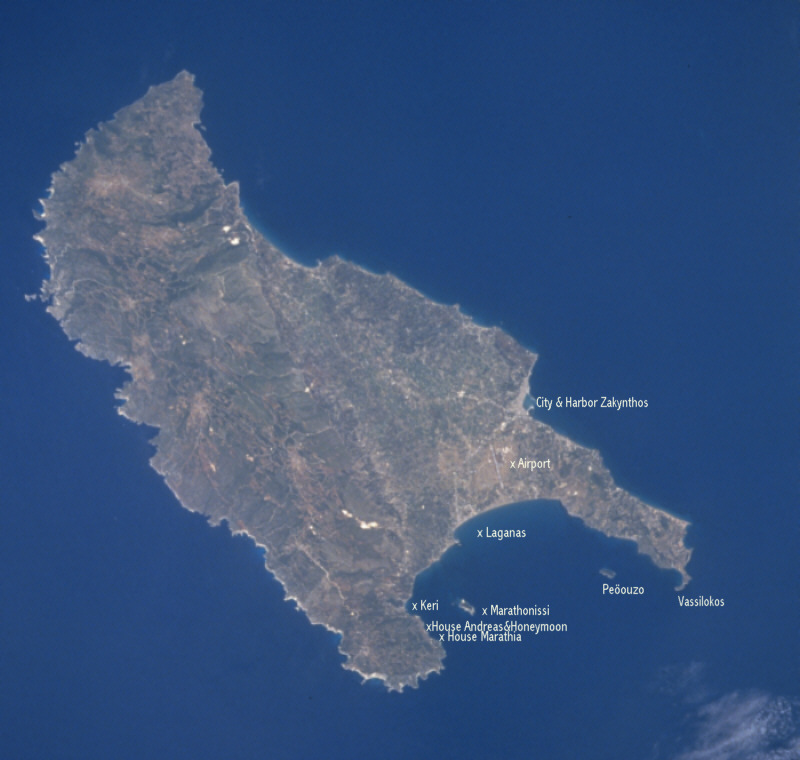

Geographic Region: GREECE
Feature: ZAKINTHOS ISLAND
|
|
Photo
#: STS078-743-076 Date: Jun 1996 Geographic Region: GREECE Feature: ZAKINTHOS ISLAND |
|
| Mission: | STS078
|
|
|---|---|---|
| Roll - Frame: | 743
- 76 |
|
| Geographical Name: | GREECE
|
|
| Center Lat x Lon: | 38.0N
x 21.0E |
|
| Film Exposure: | N | N=Normal
exposure, U=Under exposed, O=Over exposed, F=out of Focus |
| Percentage of Cloud Cover-CLDP: | 5 |
|
| Camera Tilt: | LO | LO=Low
Oblique, HO=High Oblique, NV=Near Vertical |
| Camera Focal Lenth: | 250
|
|
| Camera Look Direction: | N | The
direction from the nadir to the center point, N=North, S=South,
E=East, W=West |
| Stereo?: | Y | Y=Yes
there is an adjacent picture of the same area, N=No there isn't |
| Orbit Number: | 78
|
|
| Date: | 19960625 | YYYYMMDD |
| Time: | 102357 | GMT
HHMMSS |
| Nadir Lat: | 36.8N
|
|
| Nadir Lon: | E
|
|
| Sun Azimuth: | 167 | Clockwise
angle in degrees from north to the sun measured at the nadir point |
| Space Craft Altitude: | 145 | nautical
miles |
| Sun Elevation: | 76 | Angle
in degrees between the horizon and the sun, measured at the nadir
point |
| Land Views: | ISLAND,
COAST, HILL, PLAIN |
|